
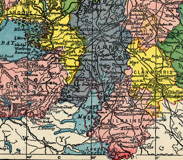
The map below is a section of a "1900" map of County Mayo. The map itself is undated and the dealer listed it as "1900" and insured that it was "turn of the century".
Some notes on this map:
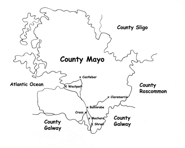
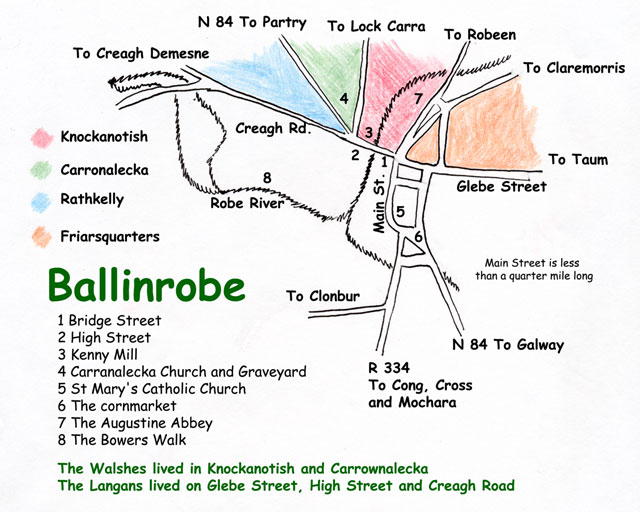
- Ballinrobe is located in the lowest "red" section of the map.
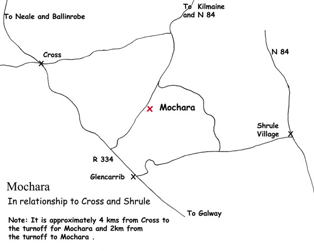
- Mochara is not indicated on the map but is located very near "Houndswood" at the very bottom of the map in the lowest "red" section.
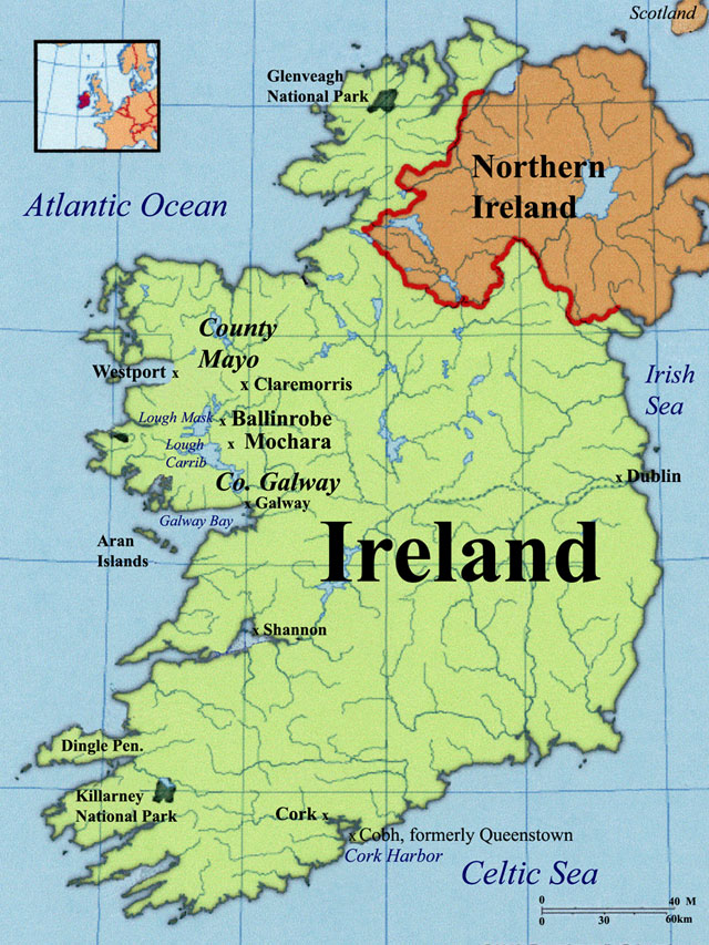
- John Walsh and Fanny Feeny were married in Castlebar, which is northwest of Ballinrobe.
- The railroad is indicated on the map as the solid black line running from Westport to Castlebar and then to Claremorris. A spur can be read from Claremorris to Ballinrobe. Before the spur was opened to Ballinrobe in 1892, emigrants from Ballinrobe went overland to Claremorris and from Claremorris took the train to Queenstown.
| JOHN WALSH | |||
| MATHIAS LANGAN | |||
| BALLINROBE | |||
| GRIFFITH VALUATION | |||
| WALSH/LANGANS INTRODUCTION | |||
| HOME PAGE | |||