|
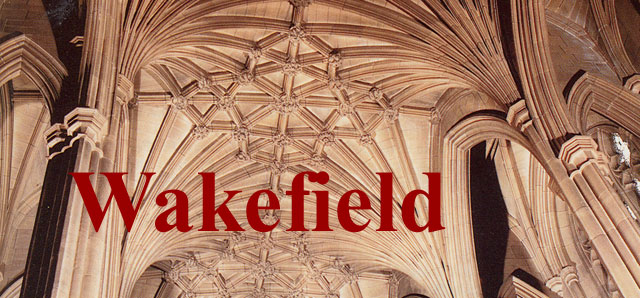
| Stone vaulting of the eastern extension of the Church of All Saints, 20th century |
| HOME - Land Introduction - The Lands - Wakefield - Wakefield Prison |
|
The Parish of Wakefield My Land ancestors were in Wakefield, Yorkshire, England from the 1730s to the 1790s. Charles Land and his wife, Elizabeth Dunford, moved from Wakefield to Leeds, between 1789 and 1797. Their grandson, John Land, moved from Leeds back to Wakefield, where he lived from at least 1848 to 1853. He was listed at Westgate Common, Alverthorpe with Thornes, at the birth of his daughter, Elizabeth Ann in 1849. In the 1851 census he was listed at 106 Clayton Hill, in the Township of Alverthorpe Cum Thornes. In January 2014 Brian from Wakefield kindly told me: Westgate Common runs from roughly the Westgate end of Ings Road to St Michaels Church, Clayton Hill runs from the end of Lawfield Lane where The Waggon and Horses pub is up the slight rise where it levels out and runs right down to the Park as Lawfield Lane. The first street on the right is Milton St. On the opposite side of the end of Lawfield Lane to the pub is a building with a rounded end recently a bridal wedding shop this was the original Clayton Hospital. Sick people could be cared for there by volunteers.Wakefield was a town*, a township, a parish, and a district in the West Riding of Yorkshire. The town is on the river Calder, nine miles south/ south/east of Leeds. The parish contained the townships of Horbury, Stanley-with-Wrenthorpe, and Alverthorpe-with Thornes. Note: * May 2011, Richard Lowther informs me that Wakefield became a city in 1888. Wakefield is dated to Roman times and it was listed in the Doomsday Book. The woolen trade was active by the time of Henry VIII (1485-1509). The priciple church, All Saints, was erected in the time of Henry III (1216-1272). However, with repeated repairs and alterations, little of the original 13th century church remains.
| |
| Lands in Wakefield
My ancestor, Charles Land, was baptized in Wakefield in 1767, the son of John Land. He married Elizabeth Dunford in Wakefield in 1787 and at least one son, James, was born in Wakefield in 1789. The family then moved to Leeds where a second known child, Charles Lewis Land, was born in 1797. Charles Lewis Land married Ann Dinsdell. They lived in Leeds where their son, John, was born in 1818. John Land and his family moved back to Wakefield where they were from circa 1847 to circa 1851. Known addresses for John Land and family in Wakefield were:
These addresses are in close proximity to one another. | |
| Wakefield from the south, 1722 | |
 | |
| Plan of Wakefield 1790 | |
 |
1790 Plan of the City of Wakefield With my designations. The Lands lived in Westgate. |
| Images of England, WAKEFIELD, compiled by John Goodchild | |
| | |
|
Bull Ring, Wakefield
The bull ring or Market Place was once an open space where bull bating with dogs once took place.
|
|
| | |
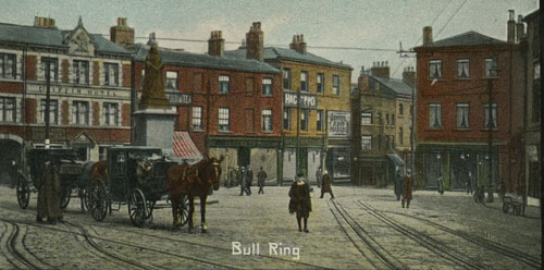 |
Bull Ring
|
| Postcard collection of Maggie Land Blanck | |
| | |
 |
Not dated
|
| Postcard collection of Maggie Land Blanck | |
| | |
| Corn Exchange | |
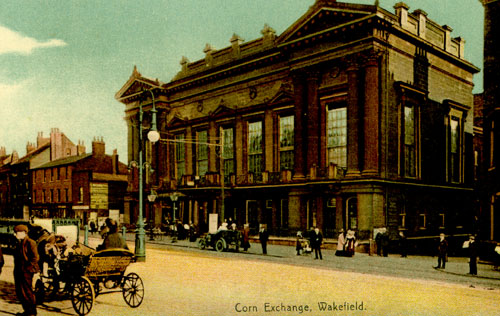 |
New Corn Exchange
The corn exchange was on upper Westgate |
| Postcard collection of Maggie Land Blanck | |
| | |
| Market Cross | |
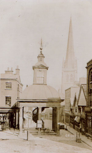 |
The Market Cross, Cross Square
The Market Cross was built in 1707. According to Walks in Yorkshire; Wakefield and Its Neighbourhood: by William Stott Banks in 1871 stated: "The Market Cross, spoken of in high terms by one of the preceding tourists, we came to think so little of as to its architecture, and found of so little use, that it was pulled down in 1866 to open out Cross Square. "The obit of John Hewitt in the Yorkshire County Magazine, Volumes 1-2 dated 1891 stated: "Mr. Hewitt, with a few friends, stood in opposition to the pulling down of the Market Cross at Wakefield, when the Corporate Oflicials demolished it for street improvements." |
| Collection of Maggie Land Blanck, copy of old photo bought on eBay 2006 | |
| | |
 |
|
| The Pageant of Wakefield and the West
Riding, 1933, Collection of Maggie Land Blanck
THE MARKET CROSS
| |
| | |
| Cattle Market. | |
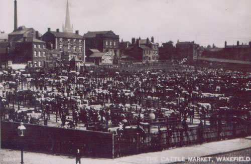 |
Cattle Market
|
| Collection of Maggie Land Blanck, copy of old photo bought on
eBay 2006
Originally held on the streets of Wakefield it was moved to George Street in 1765. In the 1800s it was the biggest cattle market in Northern England. In 1868 the market for cattle was held on Wednesdays and there were livestock fairs July 4 and November 11 for cattle horses and sheep. | |
| | |
|
River Calder and Chantry Bridge The St Mary the Virgin Chantry Chapel was built between 1342 and 1347. Chantries, built by bequests, were established as places where priests prayed for the soul of the deceased. The chapel underwent major renovations in 1848. | |
| | |
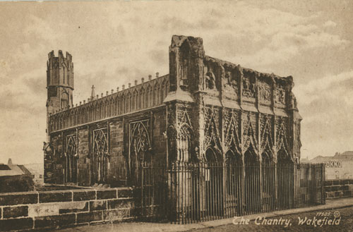 |
St Mary the Virgin Chantry
|
| Postcard collection of Maggie Land Blanck
| |
| | |
 |
Wakefield River Calder from Chantry Bridge
Not posted |
| Postcard collection of Maggie Land Blanck | |
| | |
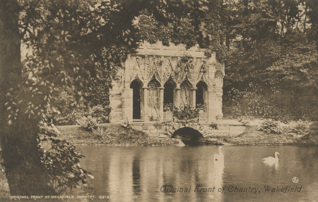
| |
| Postcard collection of Maggie Land Blanck,
June 2011
Original Front of Chantry, Wakefield The original facade of the Chantry is on the grounds of Kettlethrope Hall on the outskirts of the city. It is one a the few remaining examples of medieval bridge chapels. | |
| | |
 |
The River Calder and Chantry, Wakefield
Posted 1952 |
| Postcard collection of Maggie Land Blanck | |
| | |
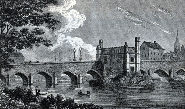 |
|
| The Pageant of Wakefield and the West
Riding, 1933, Collection of Maggie Land Blanck
WAKEFIELD BRIDGE, drawn by N Whittock, engraved by J Rogers The Chantry with All Saints steeple in the background.
| |
| | |
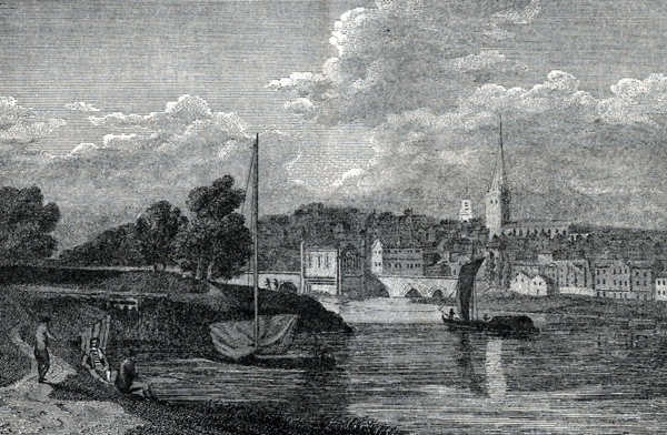 |
|
| The Pageant of Wakefield and the West
Riding, 1933, Engraving by J. Walker from a Drawing by W. Turner, 1798, Collection of Maggie Land Blanck
WAKEFIELD FROM THE CLADER (Turner) 1798 This images shows the Chantry Bridge and the steeple of All Saints. In the background is the steeple of St. John's Chruch, which was consecrated in 1795. | |
| | |
|
Northgate
| |
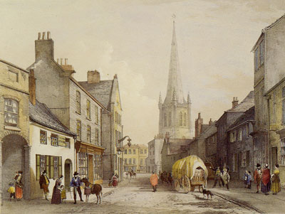
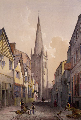
|
Northgate, Wakefield, 1853
The horse drawn wagon is approaching the town center and the church from the north. |
| Postcard from a lithograph by Rev. Thomas Kilby
In the mid 1700s the nobility lived in Northgate. | |
| | |
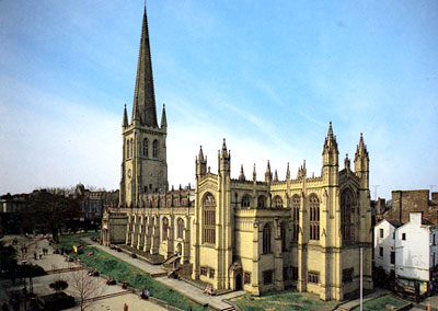
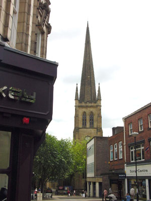
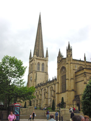
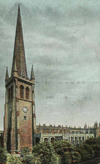
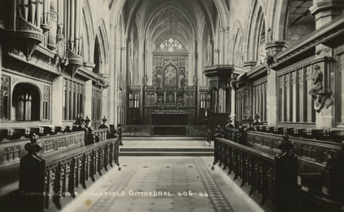
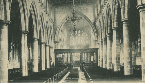
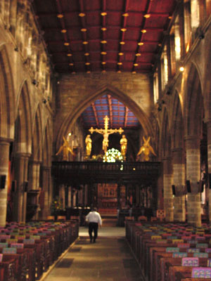
| All Saints, Wakefield
The present church was consecrated in 1329. The tower was build in the 15th century. However, in 1860-1 "the spire of the church was entirely rebuilt and provided with crockets (the immediately preceding spire having been without this feature) and raised to its present height, 247 feet, the tallest in Yorkshire." Note: A crocket is a decorative element of Gothic architecture. The parish church became a cathedral in 1888 when William Walsham How became the first bishop of Wakefield. |
 |
All Saints Parish Church
|
| Postcard collection of Maggie Land Blanck. Photograph by John Edwards | |
| | |
|
Approaching the church from the west.
Bread Street , 1853. Bread Street was originally called Bread Booths. The only bakehouse in Wakefield was set up on Bread Street in 1306. Everyone who sold bread had to bake it in the oven in the Bread Street bakehouse. |
| Postcard from a lithograph by Rev. Thomas Kilby | |
| | |
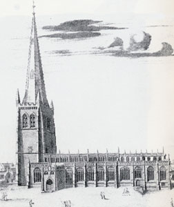
|
1690 engraving showing the church from the south
|
| WAKEFIELD CATHEDRAL | |
| | |
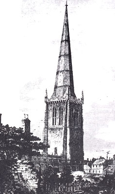
|
From the north, 1853
1853 engraving by A.B.Higham |
| WAKEFIELD CATHEDRAL | |
| | |
|
Approaching the All Saints from the west, 2002
|
| Photo by Tom Blanck | |
| | |
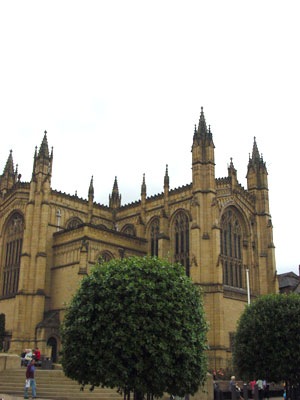
|
All Saints from the southeast, 2002
| |
 |
 |
| Photos by Tom Blanck | |
| | |
 |
All Saints
Posted 1906 |
| Postcard collection of Maggie Land Blanck | |
| | |
 |
All Saints
Not posted |
| Postcard collection of Maggie Land Blanck | |
| | |
 |
All Saints
Posted 1903 |
| Postcard collection of Maggie Land Blanck | |
| | |
|
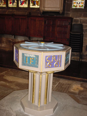
The enterior of the church, 2002
Despite the modern look of the font, the guide book says it was installed in 1660. | |
|  |
| Photos by Tom Blanck | |
| | |

|
The church reflected in the glass front of a modern building.
|
| Photo by Tom Blanck | |
| | |
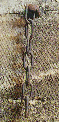
|
A punishment for scolds and gossips
On a wall of the tower buttress is this chain attached with a bolt. There used to be an iron collar (called a "joug") attached to it. Scolds, gossips, or others sentenced to church discipline in medievel times were subject to having the collar put around their neck. |
| WAKEFIELD CATHEDRAL | |
| | |
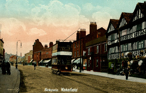
|
Kirkgate
"It is interesting to reflect that even at this late date the roads, footpaths and sanitary arrangements were of the most primitive type. Down the center of lower Kirkgate, indeed, from William Street to the bridge, flowed the Skitterick Beck, which was nothing else but an open drain, and it was only in 1771 that the passing of the Wakefield Paving Act provied the citizens with powers to put things in more seemingly condition." |
| | |
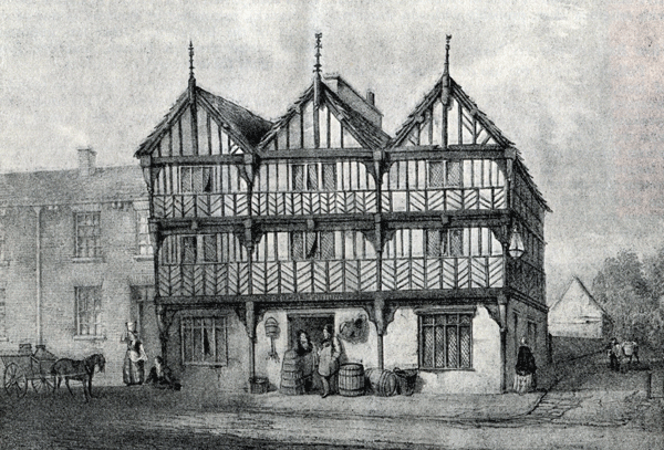
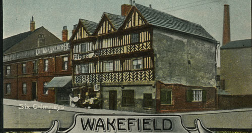 |
Six Chimneys, Kirkgate
|
| Postcard collection of Maggie Land Blanck
Six Chimneys was built in 1566 and collapsed in 1941 due to neglect and alterations in its internal structure. | |
| | |
 |
Six Chimneys and Kirkgate
|
| Postcard collection of Maggie Land Blanck | |
| | |
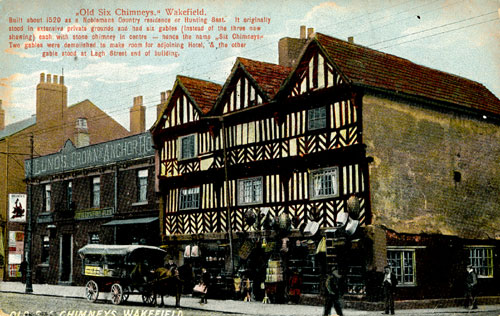 |
Six Chimneys and Kirkgate
Posted 1907 |
| Postcard collection of Maggie Land Blanck
Printed on the front: "Built about 1520 as a Noblemans Country residence or Hunting Seat. It originally stood in extensive private grounds and had six gables (instead of the three now showing) each with a stone chimney in centre- hence the name Six Chimneys. Two gables were demolished to make room for adjoining Hotel & the other gable stood at Legh Street end of buliding" | |
| | |
 |
|
| The Pageant of Wakefield and the West
Riding, 1933, Collection of Maggie Land Blanck
THE SIX CHIMNEYS
| |
| | |
| |
| Postcard collection of Maggie Land Blanck,
June 2011
Reproduction of a 1905 postcard of Kirkgate Wakefield. An Edwardian view, c. 1905, of the busy shopping street. All the buildings on the left were demolished in the road widening scheme." | |
| | |
| Embossed in corner "23 Wood St, Wakefield" |
| Copy of old photo bought on eBay 2006, collection of Maggie Land Blanck
In November 2015 Mrs. A. M. McFarlane wrote: 23 WOOD STREET WAKEFIELD, is incorrect. It is of STANLEY ROAD, WAKEFIELD, showing MOORE VILLA and what was later the CO-OP, I lived in a shop at 106 STANLEY ROAD, from the 1950's. Between us and the buildings in your picture was BAGNALL TERRACE."In November 2018 Mick D'Arcy wrote: "The address on the card which you believed to be incorrect, may have been embossed with the address of the photography shop. I have noticed that practice in the past. Wood street still appears to be a centre for photography." | |
| | |

| |
| twixtaireandcalder.org.uk, collection of Wakefield Local Studies Library
Drawing by Henry Clarke - BACK LNE FROM WESTGATE - The south end of Wakefield prison can be seen at the end of the street.
| |
| | |
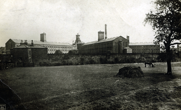
| Clayton Hill, West Gate Common The Land Family lived at Westgate Common in 1849 and 1852 and were listed at Clayton Hill, Alverthorpe with Thornes in 1851 census. The 1890 Ordnance Survey map shows Clayton Hill running parallel to Westgate End. I am assuming Westgate Common and Clayton Hill are one and the same given the overlap of dates.
There were a number of mills shown in the neighborhood: Westgate Mills, Albion Mills, City Worsted Mills, Ing Road Mills, Chald Mills, and Providence Mills. I do not know what kind of mills these were of if they were in existence at the time the Lands lived in the area.
Hand-weaving has long been superseded by the use of machinery for spinning, weaving and finishing woollen cloth, and we have now in the town and neighbourhood, the Woollen manufactories of Messrs. George Stubley and Son, Porto Bello mills; Mr. J. S. Booth, Castle Bank mills; Messrs. Wade, Playfair and Company; Messrs. Colbeck, Brothers; and others.
In describing the great Yorkshire Election of 1807 Henry Clarkson stated: The excitement in Wakefield was tremendous, and much rejoicing was displayed by the victorious party; there were many gay doings to celebrate the event, and among other sights I recollect one which made an impression on me - this was seeing an old woman, who lived on Clayton Hill, "chaired" all round the town, by some humble but enthusiastic admirers of Lord Milton, in honour of his return. She was always afterwards called "Lady Milton," and the street on Clayton Hill where she lived is known to this day as Milton Street.In 1851 Westgate Common contained a large number of workers connected with worsted manufacturing, prison workers of various stripes, masons, smiths (blank and white), cloth dressers, dyers and miscellaneous others. John Land was the only cloth drawer. The 1853 Trade Directory for Wakefied did not list John Land or any other cloth drawers in Wakefield. It did ist three cloth finishers: George Harrison, Ings Road, house 16 Quebec Street, James Holt, Horbury Road, Jno Naylor & Co, Westgate Common. The population of Wakefield in 1851 was 22,066.
|

| |
| twixtaireandcalder.org.uk, collection of Wakefield Local Studies Library
Drawing by Henry Clarke - MILTON STREET, WESTGATE COMMON, WAKEFIELD
| |
| | |
|
|
The Prison, Wakefield Posted 1923 |
| Collection of Maggie Land Blanck, June 2011
For more images of the prison go to Wakefield Prison | |
| | |
Zion Congregational Church
|
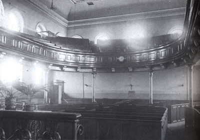
|
Enterior of the Zion Congregational Chapel on George Street
This enterior was not what was seen by Charles Land and Elizabeth Dunford when their son, James, was baptized in this church in 1789. The church was rebuilt in the 1840s on the same site as the old church established in the early 1780s. In May 2011 Richard Lowther wrote that the Zion Congregational Church is now luxury apartments.
|
| Images of England, WAKEFIELD compiled by John Goodchild | |
| | |
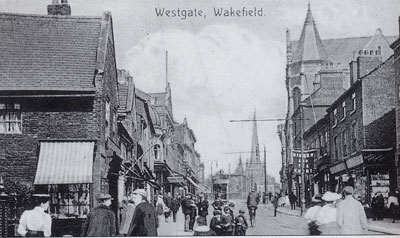
|
Westgate Looking towards the church of All Saints |
| Postcard collection of Maggie Land Blanck | |
| | |

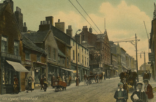
|
Westgate
Looking towards the church of All Saints. |
| Postcard collection of Maggie Land Blanck | |
| | |
 |
Westgate
Not posted |
| Postcard collection of Maggie Land Blanck | |
| | |
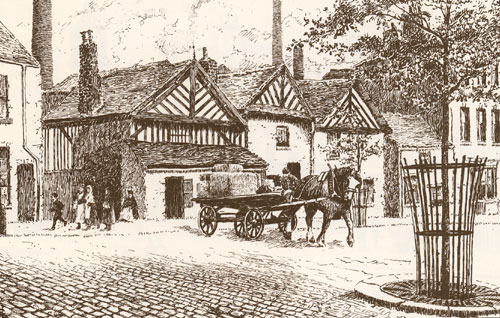 |
Timber frame houses, Westgate, 1890s |
| Drawing by Henry Clarke | |
| | |

| |
| Postcard from a lithograph by Rev. Thomas Kilby
On March 16, 2009 Terry Stead wrote: "This is looking along Little Westgate, some of the buildings on the left are still there. You have another just further on looking down Bread Street. Bread Street runs parallel with Little Westgate in fact the buildings on the left of Little Westgate have their back in Bread St. If you compare the Cathedral in both you will see the it is the same aspect. | |
| | |
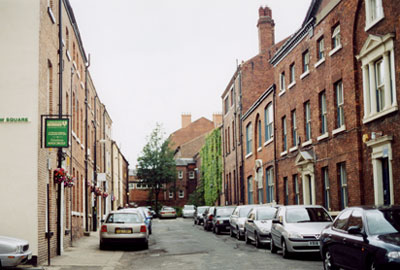
|
One of the streets off Westgate
|
| Photo by Maggie Blanck | |
| | |
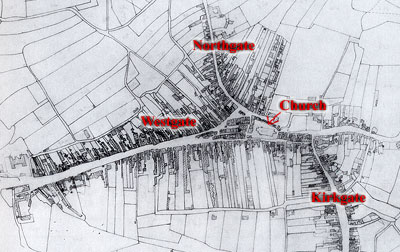
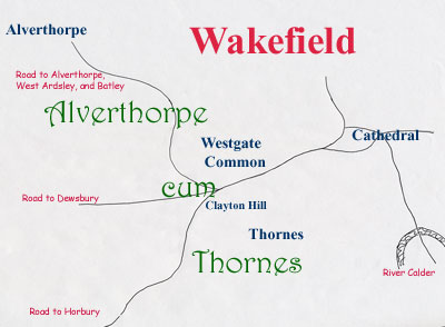
| Alverthorpe cum Thornes (Alverthorpe with Thornes)
was a term used to cover all of the area to the west of the city of Wakefield. Alverthorpe was a hamlet to the
northwest of the city and Thornes was a hamlet to the southwest of the city. Westgate Common lies between Alverthorpe and Thornes on the north side of the road to Dewsbury just outside the town proper. The map shows the locations of Westgate Common and Clayton Hills, two "addresses" connected with John Land, when he lived in Wakefield in the mid 1800s. |
 |
|
Alverthorpe All of the area north of the road to Dewsbury is new. As a matter of fact, there was a lot of construction of new developments going on when we visited in June 2002. A little further northwest just before getting to Alverthorpe is an area called, Flanshaw, where there was this group of "older" houses. |
| Photo Maggie Land Blanck | |
| | |
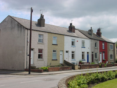
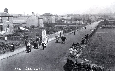
 |
Alverthorpe
Date unknown |
| Copy of old photo bought on eBay 2006, collection of Maggie Land Blanck
In June 2014 Jean Richardson wrote: The photo is taken on Batley Road in Alverthorpe, just after the junction with Flanshaw Lane if you want to have a look on a satellite map. Both the buildings on the photo survive, the building on the right was Alverthorpe Methodist Chapel where I was baptised but is no longer used as a place of worship. The building on the left is the former Alverthorpe Infants School, where I went to school from age 4 years. It is now a community building where various groups meet. There are a number of photos of old Alverthorpe in existence and a comprehensive Wakefield Archive of information. | |
| | |
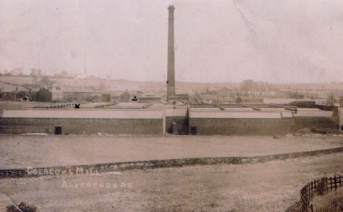 |
Colbeck Mill, Alverthorpe
Date unknown |
| Copy of old photo bought on eBay 2006, collection of Maggie Land Blanck | |
| | |
| West Ardsley is a village between Alverthorpe in Wakefield Parish
and Morley in Batley Parish.
|
|
West Ardsley William Law and his family lived in West Ardsley from at least 1838 to 1840. Emma Law was born in West Ardsley in 1838 and Littice Law was born in West Ardsley in 1840. |
| Images of England, WAKEFIELD compiled by John Goodchild | |
| | |
| Sandal Sandal (or Sandal Magna) is a suburb two miles south of Wakefield. It was recorded in 1086 in the Doomsday Book as having a church with a priest. |
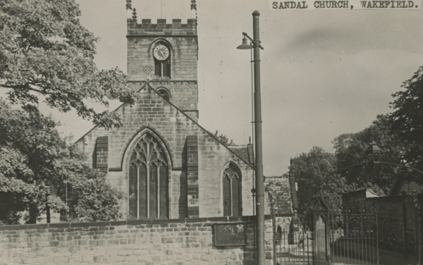
|
| Postcard collection Maggie Land Blanck, June 2011
Sandal Church
|

| |
| Postcard collection Maggie Land Blanck, June 2011, from
a reproduction of a photo bought on ebay.
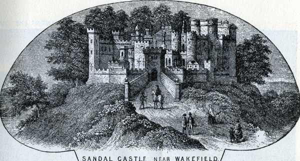
Sandal Castle Ruins Sandal was a medieval fortified castle belonging to the Manor of Wakefield. The Ancient Manor of Wakefield was largely covered in forest. King Edward the Confessor (1003-1066) was the first known Lord of the Manor. After the battle of Hastings in 1066 the property passed to William the Conqueror. Yorkshire men rebelled against William in 1068. In retaliation William and the Normans ravaged the land destroying homesteads, villages and towns. The area was devastated. When the Doomdday Book was compiled 16 years later the value of the Manor of Wakefield was a forth of what it had been in the time of the Confessor. In 1091 the manor was granted by the king to his nephew, William, 2nd Earl of Warenne and Surrey. The third Earl died in Palestine during the crusades. In 1204 the 6th Earl was granted a charter to hold a fair at the feast of All Saints. In 1258 he obtained an additional charter to hold a fair at the feast of St. John the Baptist. The 8th and last Earl died in 1347 without heir. The Manor of Wakefield reverted to the crown.
| |
| | |
 |
|
| The Pageant of Wakefield and the West
Riding, 1933, Collection of Maggie Land Blanck
SANDAL CASTLE NEAR WAKEFIELD
| |
| | |
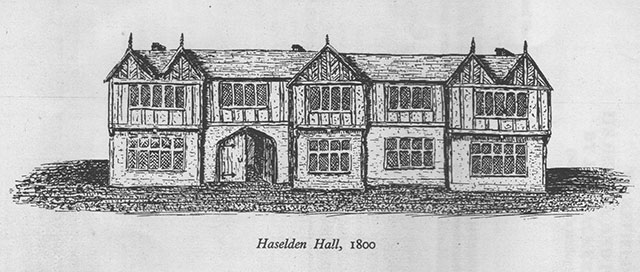
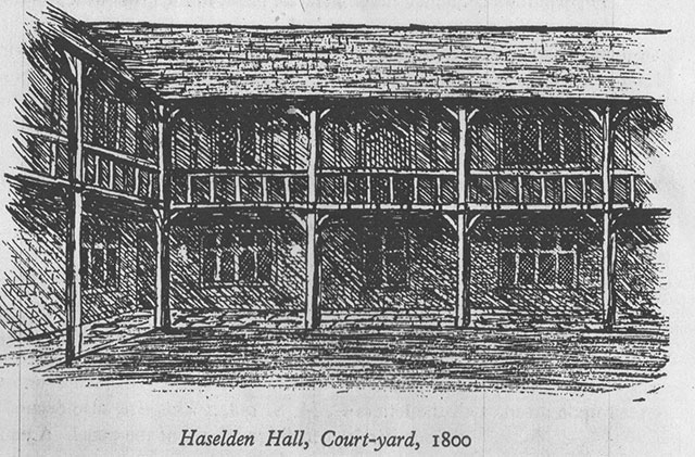
| Haselden Hall Haselden Hall Wakefield (also called North Gate) was an old "burgage"* house built in Elizabethan times. It was located at the Northern extreme of the city of Wakefield and was the home of the Wentworths and Saviles.
"At an old mansion in Northgate, Wakefield, known as Haselden hall, and said to have derived its name from a family which lived in it in the reign of Henry VI. are other memorials of the Saviles. The date 1584 is frequently repeated on the ceiling, with shields of the arms of Savile, two of them bearing the differences of a crescent and a mullet, being the same as are carved on stone over the ancient gateway of Wakefield Grammar-school" "Haselden Hall is an old building that was chiefly wood, but which has been cut into two parts and re-fronted, whereby its ancient character and picturesqueness have been destroyed. The detached parts still contain memorials of the Saviles. After the death of Thomas Savile, without issue, it passed to Sir William Wentworth, and afterwards to the Lords Strafford, of the second creation, and at the death of the last Earl it went to his sister, Mrs. Hatfield Kaye, of Hatfield Hall, and afterwards by devise to Mr. John Harter, who took the name of Hatfield. Sir William Wentworth, father of the Earl. Sir William married Isabella, daughter of Sir Allan Apsley, Knt. Treasurer to the household of the Duke of York (afterwards King James II.), by whom he had issue five sons and six daughters. Sir William inherited the greater part of the Savile estates at Wakefield, in right of his mother. "In legal documents of the time," says Mr. Cartwright, " he is usually described as of that town, but it does not appear that he was for any considerable time a resident there, all his family with one notable exception having been born elsewhere. In 1672, his newly acquired estates in Yorkshire had given him such a position in the county that he was chosen to serve the office of High Sheriff; and there is every reason for believing that during his year of office he occupied Stanley Hall, near Wakefield, at the time the property of the Pilkington family. At any rate, his son Thomas was born there, if we may take an assertion of that fact in one of his own letters as true. The parish registers of Wakefield prove Thomas to have been baptized in the old church of that town on September 17th, 1672. Six months afterwards, that is about the time of the termination of Sir William Wentworth's Shrievalty, and of his election as Member of Parliament for Thirsk, the family moved up to London, where the influence of the Apsleys was sufficient to procure for Lady Wentworth, and for most of her children as they grew up, appointments of more or less value connected with the Court."*Burgage is a mediaval term for a town rental property owned by the king or a lord. Wikipedia Burgage The house no longer stands. |
|
| Image courtesy of Peter Cockerill, September 2014 - Wakefield Its History & People by JW Walker 1934
Peter writes: "It was bricked up in the early 18th century so the timber appearance was lost - also the east and west wings were pulled down leaving two separate buildings with their gables facing onto Northgate. The south wing was pulled down later in 20th century and finally the north wing was demolished in 1967." |
|
| Image courtesy of Peter Cockerill, September 2014
- Wakefield Its History & People by JW Walker 1934
|

|
| Image courtesy of Simon Booth, December 2015
In December 2015 Simon Booth shared this image of his great, great grant father, John Samuel Booth who was mayor of Wakefield in 1892 and owned Castle Bank Mills. Birth: Circa 1846 to John Booth Morley Blacksmith and his wife Martha. 1851: Windmill Lane, Morley cum Chruwell, John Booth , 45, blacksmith, Martha 45, Mary Ann 19, sress maker, Elizabeth 15, Rebecca 13, Jane 11, Sarah, 9, John Samuel 5, Martha 3, James Brown, 23, journeyman blacksmith, Thomas Booth, 18, apprentice blacksmith 1861: Windmill Lane Morley, John Booth 56, smith and quarry owner, Martha Booth 56, Jane Booth 21, Sarah Booth 19, Martha Booth 13, John S Booth 15, James Wordsworth 18, blacksmith, James Wright 15, blacksmith 1867: Marriage March 7, parish church at Batley, John Samuel booth age 21 bachelor manufacturer, born Morley son of John Booth blacksmith, to Eunice Ann Holroyd 20 spinster, born Morley daughter of John Holroyd farmer. 1871: Belle Isle, Wakefield, John Saml Booth 25, wollen cloth manufacturer employing 44 hands, Eunice Ann Booth 24, John Holroyd Booth 3, Louise Booth 1, Sarah Holroyd 50, mother in law, Annie Hartley 17, servant 1881: Castle Bank House, John S. Booth 35, Cloth Manfr Employing 130 Hands, born Marley (Morley?) Eunice A. Booth 34, wife, Lois Booth 11, Constance Booth 8, Henry Booth 6, Eveline Booth 4, James Booth 8 months, Sarah Holroyd 60, mother in law, Edith Crowther 28, domestic, Emma Ashton 21, domestic 1891: Castle Bank House, John Samuel Booth 45, cloth manufacturer, born Morley, Eunice A Booth 44 John H Booth 23 Lois Booth 21 Henry Booth 16 Sarah Holroyd 70 Clara Foster 27 1885: John Samuel booth, Wakefield Manufacturer (History of the Free Grammar School of Queen Elizabeth at Wakefield) 1887: John S., Castle Bank mills, Wakefield, warehouse, Britannia street, and York place (The Commercial Directory and Shippers Guide) 1911: Castle Bank House Wakefield John Samuel Bootle 65, Chairman Of Company, born Morley, Eunice Ann Bootle 64 James Bootle 30 Sarah Glover 69 Mary Andrewartha 25 Jeannie Milward 24 1920: John S Booth, Date of Registration: Dec 1920, Age at Death: 75, Registration district: Wakefield, Yorkshire West Riding, Volume: 9c, Page: 69
|
| If you have any suggestions, corrections, information, copies of documents, or photos that you would like to share with this page, please contact me at maggie@maggieblanck.com |
|
Please feel free to link to this web page.
Maggie
|
| © Maggie Land Blanck - page created 2004 - latest update, November 2018 |