Johann Berend Petermann from Ganderkesee
My great grandfather, Johann Berend Petermann, was born in Ganderkesee, Germany in 1843. He spent 14 years at sea with the Bremen Merchant Ships. He married and had his first child in Germany. The family emigrated to the United States circa 1881 where they settled in Hoboken, New Jersey. See Johann Berend Petermann.
There were Petermanns in Ganderkesee as early as 1699.
Other related families in Ganderkesee were: Alffs, Auffarth, Bremermann, Dranteman, Engelbart, Fohne, Forstein (Forstens), Goden, Hagestedt, Hayen, Hofrogge, Mencke (Menckens), Meyers (Meiers), Mullers, Neelss, Oldesbrusch, Ordermann?, Osterloh, Platen, Saalfeld (Sahlfeld), Schwarting, Stuthof, Uhlhorn, Von Ritter(n), Warrelmanand Wieting.
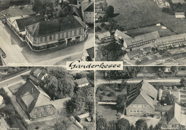
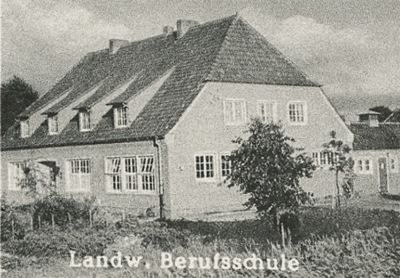
The Parish of Ganderkesee
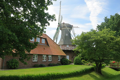
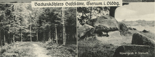
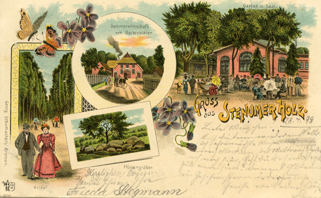
The parish of Ganderkesee included the town of Ganderkesee and the hamlets of: Almsloh, Bergedorf, Bookholzberg, Bookhorn, Bürstel, Elmeloh, Falkenburg, Grüppenbühren, Habbrügge, Havekost, Heide, Hengsterholz, Hohenböken, Holzkamp, Hoyerswege, Hoykenkamp, Immer, Neuenlande, Rethorn, Schierbrok, Schlutter, Schönemoor, Steinkimmen and Stenum. (Wikipedia, 2012)
- Heinrich Auffarth lived in Hohenboken at the birth of his daughter, Beke, in 1823.
Johann Hinrich Engelbart was born in Schlutter in 1780.
- Wilke Osterloh was died in Buerstel in 1734.
- Dirk Osterloh was born in Immer in 1641.
- Thrine Osterloh Mencke died Habbruegge in 1785.(Same family of Osterloh.)
- Alert Mencke was born in Schlutter in 1575.
- Sophie Hedwig Schwarting was born in Schlutter in 1787.
-
In the late 1860s Johann Berend Petermann gave his address as Hoyerswege.
- "Sethe" the birthplace of Johann Christopher Petermann in 1810. Google map shows Sethe as a small cluster of of buildings near Havekost.
- "Landwehr" was the residence of Johann Berend Petermann born 1812. The current google map shows at least three large farms in Landwehr. See Landwher below.
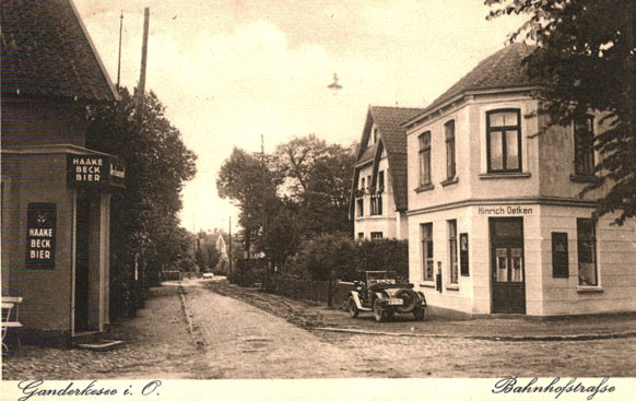
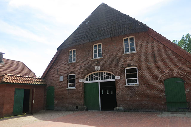
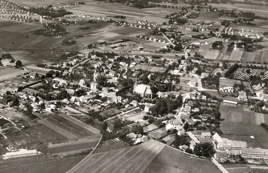
The municipality of Ganderkesee lies between the Hunte and Weser rivers on the northern edge of the Wildeshauser Geest Nature Park in the council of Oldenburg in Lower Saxony.
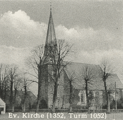
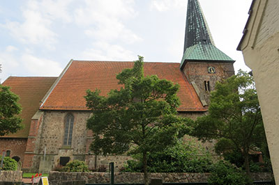
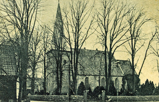
The village of Gandekesee is the center of the municipality and dates back over a thousand years. The Gaukirke, St Cyprian and Cornelius, the first stone church, was built in 1052 and contains an organ from 1699.
The old village was tightly clustered around the church. The thatched roofs of the houses were very flammable and the town was almost completely destroyed by fire at least three time in a hundred years, causing great hardships for the local population.
Ganderkesse was a market town and held an annual festival.
The area was ruled by the count of Oldenburg who built a castle nearby in Delmenhorst in 1260.
The area was under Danish rule from 1667 to 1773. It was ruled by Duke Peter Freidrich Ludwig I Duke of Oldenburg from 1785-1829.
When we visited in June 2012 we were impressed that for a town of its age, many of the buildings in Ganderkesee appeared relatively new. We also heard that the church roof was damaged by fire in 1945. In 1954 there was the "removal of the last damages of the war reconstruction of the helmut of the tower". This made us wonder why the area was bombed during the war. One local target was the hamlet of Hoykenkamp north east of the town of Ganderkesee. Focke-Achgelis helicopters were manufactured in an old margarine factory at Hoykenkamp starting in 1937. It was the target of a British raid the nights of June 29 and 29, 1942. The city of Oldenburg was bombed during WWII. However, Oldenburg did not suffer the damage of other German cities. It actually became a destination for refugees after the war because there was minimal damage to Oldenburg and the neighboring towns. The city of Bremen was bombed repeatedly between 1940 and 1945 with various raids targeting the railroad station, shipyards, an oil refinery, a steel mill and other plants. Many buildings in Bremen were destroyed during these air raids. Bremen cathedral was severally damaged in an air raid in 1943. Most of the Bremen passenger lists were also destroyed by fires during WWII.
In March 1940 British planes dropped leaflets over Ganderkesee urging the Germany population to insist on peace.
1857 Population and size: 91 inhabited buildings, 81 uninhabited buildings, 115 households, 292 males and 282 females total population 574 - Statistische Nachrichten uber den Freistaat Oldenburg, Volumes 2-3 By Oldenburg (Staat)
Ganderkesee Parish Church
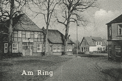
St. Cyprian and Cornelius, Ring 14, 27777 Ganderkesee, Phone: 04222 / 942 00. The records for St Cyprian and Cornelius have been micorfilme in part by LDS — films # 143101 and 143102.
Go to Die Gaukirche St. Cyprian- und Cornelius in Ganderkesee to see images of the church.
In ancient times there were seven chapels in the parish of Ganderkesee: Bergedorf, Kirchkimmen, Habbrügge, Gruppenbüren, Stenum, Schlutter and Bürstel. It was too expensive to maintain all of the chapels and so it was decided to build one large main church. Legend has it that the local farmers did not know where to built the church so the decided to let a white goose fly and when it landed they would build on that spot. Following its natural calling, the goose landed in a pool in the valley where the church now stands. The pool had to be filled with nearby earth so the church could be built. And so the place was named Ganderkesee and the arms of the town contain a white goose.
On the left of the entrance on the south side of the church is a stone wall with a small cloven hoof and the end of an animal's tail. When the church was under construction it was thought that the devil wanted to destroy it but wanted to wait until the last minute so that the people would be tortured even more and not want to start the construction again. The devil had the power to destroy the church as long as the pulpit was not finished. After that he lost his power. The smart people of Ganderkesee installed the pulpit long before the church had a roof. When the devil saw the pulpit installed in the unfinished church he was so mad he stood with his back against the wall and pushed angrily but it was too late, his power had passed. A trace of his hoof and tail remain in the wall. Aberglaube und Sagen aus dem Herzogthum Oldenburg, Volume 2 By Ludwig Strackerjan, 1867
The church in Ganderkesee:
Die Kirche der Gemeinde steht zu Ganderkesee. Die Zeit ihrer Erbauung ist ungewiß und die Angaben schwanken zwischen 1050 und 1352. Die letztere Angabe wird die richtigere sein, weil die Hatten-r gewiß, wennschon 1050 zu Ganderkesee eine Kirche gewesen wäre, nicht bis 1192 nach dem fernen Niefelstcde, sondern hierher zur Kirche gegangen wären. Der Platz für den Kirchenbau soll nach der Sage zwischen da umliegenden Ortschaften streitig gewesen sein. Um den Streit zu entscheiden, ließ man einen geblendeten Gänserich fliegen unter der Verabredung, daß dahin die Kirche gebaut werden solle, wo der Gänserich sich niederlasse. So geschah es, und der Ort erhielt davon seinen Namen, der in des Drosten von der Specken oldenburgischem Erdbuch von 1428 "Ganderkescde" (de Gander lese de) lautet. Die Kirche ist groß, hat 2 groée Glocken, eine schöne große Orgel und einm hohen schlanken Thurm, der jedoch vor seinem Einsturz im Jahre 1703 viel höher gewesen sein soll."The community church is in Ganderkesee. The date of construction is uncertain but estimates vary from 1050 to 1352. The latter figure is more correct because certainly through 1050 (I don't understand the rest, something about going to church until 1192 in distant "Neifelstcde" but have gone to church here.) According to myth, the site of the church was chosen when the locals villages decided to resolve the location dispute by allowing a gander to fly around until he "took up residence". And so it happened and the place is named for the gander "used in the Drosten of the bacon oldenburgischem Erdbuch of 1428". The church is large, has 2 large bell, a tall and beautiful organ and a single commission tall slender tower, which was, however, before its collapse in 1703 much higher.
Das Grossherzogthum Oldenburg: topographisch-statistische Beschreibung desselben By Karl Georg Böse 1863
Ganderkesee Parish Church Information From a handout at the church June 2012In the 9th century there was a wooden church at a 6th century Teutonic settlement. This church was destroyed by fire. Excavations have revealed that people were buried in tree coffins on both sides of this ancient wooden church.
About 1050 archbishop Adalbert of Bremen ordered the construction of a simple stone hall fashioned from erratic stone blocks without a tower.
In the 12th century the church was enlarged towards the East with a half round choir and towards the West with a tower.
In the 13th century low aisle extensions were added both North and South.
In the 15th century the church was rebuilt in the Gothic style with large columns and windows. The tower remained unchanged.
The church became Protestant in 1543.
In 1699 the organ was constructed by Arp Schnitger.
In 1744 the Gothic alter was removed because it was too "Catholic". Some parts of the Gothic altar are now in the Oldenburger Landesmuseum.
In 1945 there was a fire in the tower and the roof truss. The organs was saved.
In 1974 "removal of the last damages of the war reconstruction of the helmet of the tower."
In 2003 and 2005 the organ was reconstructed at great expense.
The gander and lake legend is told. A more likely derivation of the town name comes from the given name GANDERIK (a combination of Gander and Rik) meaning something like "a man who rules by his mental attitude". The name of the town was GANDERKESCHE in 1584.
Additional Information From Another Handout At The Church, June 2012
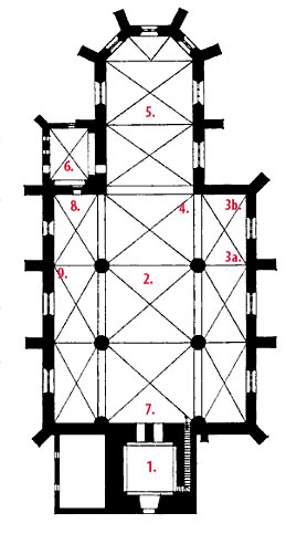
- Upon entering the church from the front one is in the tower porch, "with its thick walls date to the 12th century, when it was added to the existing stone church, erected about 100 years earlier."
- The present dimensions of the central hall go back to about 1450, 100 years before it was changed to a Protestant church.
- "Looking to the right you see two un-restored box pews. These secluded family pews were owned by the nobles and landlords, to attend church services separated from the "common" people. In our church they belonged to the estates of Nutzhorn (3a) and Elmeloh (Family "von Witzleben") (3b)
- Two steps lead to the chancel. "For centuries the gospel has been preached every Sunday."
- The altar was donated by the von Witzleben family in 1744.
- The old sacristy is to the left as you face the altar.
- The Arp-Schnitger-Organ was dedicated in 1699. A console and pedal division was added by Hinrich Klapmeyer in 1760.
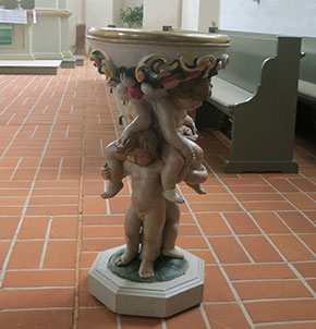
- The church contains and old Romanesque font that is older than the church itself. It was found on a farm being used as a sink. It is not certain that this font came from this church or another.
- Some ancient tombstones have been moved from the floor to the north wall of the church to perserve them from the deterioration.
Maggie Land Blanck, July 2012, Die Bau- und Kunstdenkmaler des Herzogtums Oldenburg, Volumes 4-5 By Oldenburg (Germany). Staatsministerium, Oldenburg (Grand duchy). Staatsministerium, 1907
Ganderkesee Parish Church Floor Plan with numbers corresponding to Additional Information From another handout at the church, June 2012
Handbuch einer historisch-statistisch-geographischen ..., Volume 2, Issue 1 By Ludwig Kohli, 1825 listed three noble estates in the Parish of Ganderkesee: Elmetoh, Holzkamp and Nutzhorn.
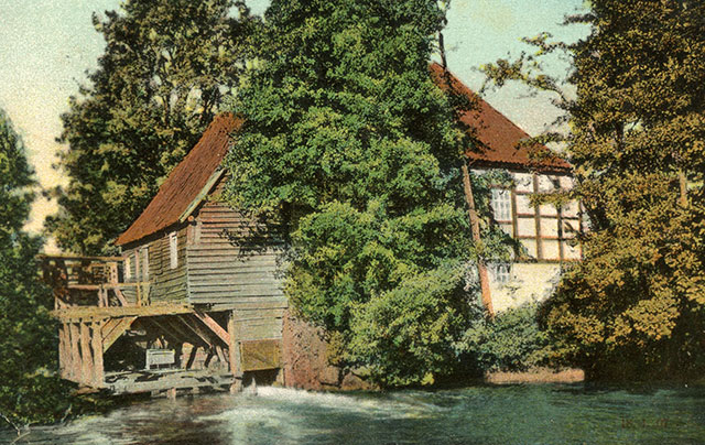
Elmeloh is one of the oldest farming communities in Ganderkesee. The watermill in Elmeloh dates to 1445. From at least 1480 Elmeloh was in the control of the Mandelsloh family, knights who lived in a fortified house surrounded by a moat. In 1692 the estate passed to the Dane Kurt Veit von Witzleben (1645-1719). The church altar was give by Adam Lewin von Witzleben who remained childless and who died in 1745. He was succeeded by his nephew, Adam Lewin von Witzleben, the younger, who died in 1766.
The Witzleben family pew with its painted coat of arms and inscribed names dates from 1711. Die Bau- und Kunstdenkmaler des Herzogtums Oldenburg, Volumes 4-5 By Oldenburg (Germany). Staatsministerium, Oldenburg (Grand duchy). Staatsministerium, 1907The nobility at Nutzhorn appear in the 16th century. Later the manor came into the Ompteda family. In 1792 it was sold piece by piece by the Countess Ompteda and the husband of her daughter, the Earl of Munster. Die Bau- und Kunstdenkmaler des Herzogtums Oldenburg, Volumes 4-5 By Oldenburg (Germany). Staatsministerium, Oldenburg (Grand duchy). Staatsministerium, 1907

Die Bau- und Kunstdenkmaler des Herzogtums Oldenburg, Volumes 4-5 By Oldenburg (Germany). Staatsministerium, Oldenburg (Grand duchy). Staatsministerium, 1907
Interior of Ganderkesee Parish Church showing the pew of the Witzleben family.
Die Bau- und Kunstdenkmaler des Herzogtums Oldenburg, Volumes 4-5 By Oldenburg (Germany). Staatsministerium, Oldenburg (Grand duchy). Staatsministerium, 1907
Windows Ganderkesee Parish Church.

Photos Maggie Land Blanck, June 2012
GANDERKESEE PARISH CHURCH ROMANESQUE FONT AND LATER FONT
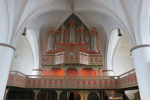
Photo Maggie Land Blanck, June 2012
GANDERKESEE PARISH CHURCH ORGAN
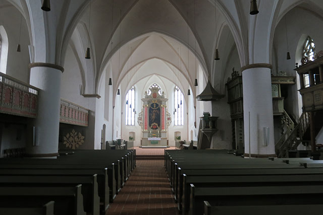
Photo Maggie Land Blanck, June 2012
GANDERKESEE PARISH CHURCH INTERIOR SHOWING THE ALTAR IN THE CENTER WITH THE PULPIT AND THE PEWS OF THE NOBILITY ON THE RIGHT
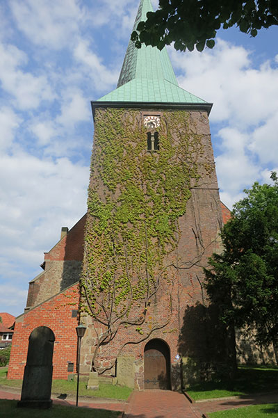
Photo Maggie Land Blanck, June 2012
GANDERKESEE PARISH CHURCH EXTERIOR
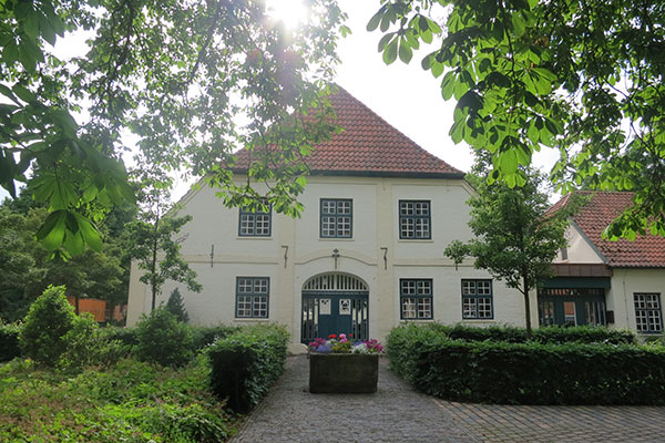
Photo Maggie Land Blanck, June 2012
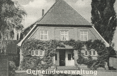
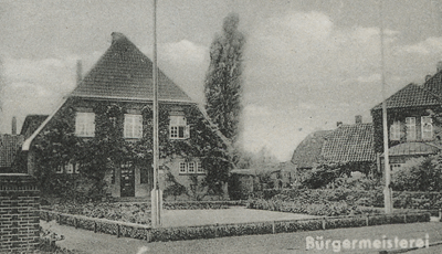
ev. Gemeindehaus [PARISH HOUSE]
The parish records
- Christening records: 1637 - 1878
- Marriage records: 1657 - 1907
- Death records: 1657 - 1905
Die Gaukirche St. Cyprian- und Cornelius in Ganderkesee
Die Gaukirche St. Cyprian- und Cornelius in Ganderkesee
Ganderkesee Website
Ganderkesee Official Web site in German